Explore Richmond's history with a self-guided, walking tour of Richmond's art and statues on the Riverfront.
Public Art and Statues Along Richmond's Riverfront
Starting on downtown’s north side of the James River from west to east
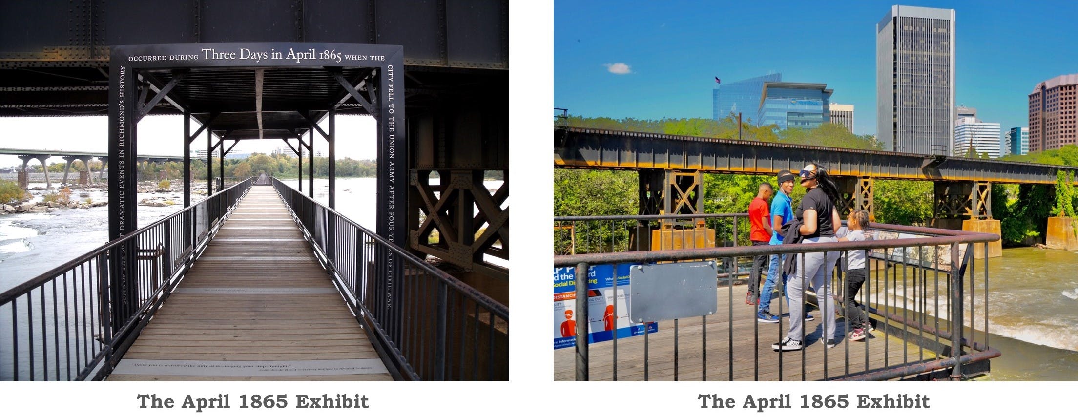
The April 1865 Exhibit
Some of the most dramatic events in Richmond’s history occurred during three days in April 1865 when the city fell to the Union Army after four years of civil war. As the Union Army marched down Broad Street, the Confederate Army evacuated while enslaved Richmonders gained their freedom. These events are memorialized on a bridge overlooking the James River. Quotes, images and views of the remains of Civil War-era bridges bring back the extraordinary events of the war’s end. A series of markers are incorporated into the James River overlook on the northwest corner of Brown’s Island. The exhibit can be reached from Tredegar Street near South 5th Street.
Public Art and Statues on Brown's Island
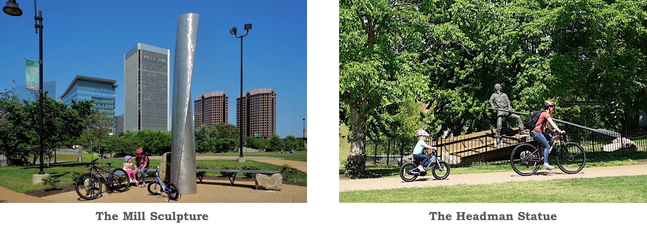
The Mill Sculpture
“The Mill,” a sculpture by Richmond artist Brad Robinson, is located near the entrance to the T. Tyler Potterfield Memorial bridge toward the south side of Brown’s Island. Unveiled in 2012, it is intended to reflect the shimmering waters of the James River. It stands 16 feet tall and is made of brushed aluminum with bronze edging. The sculpture has a crescent-shaped bench around it, which creates a nice viewing spot.
The Headman Statue
The Headman Statue on Brown’s Island depicts a 19th century boatman — also known as a headman — and commemorates the early contributions of African Americans to commerce in Richmond. Boatmen were essential to Richmond’s canal system, which provided faster transport of raw materials and finished goods around the falls of the James River. The statue is 14 feet high with a 23-foot “sweep,” or oar, and it was designed and created by Paul DiPasquale. The bronze version of the statue was unveiled in November 1993.
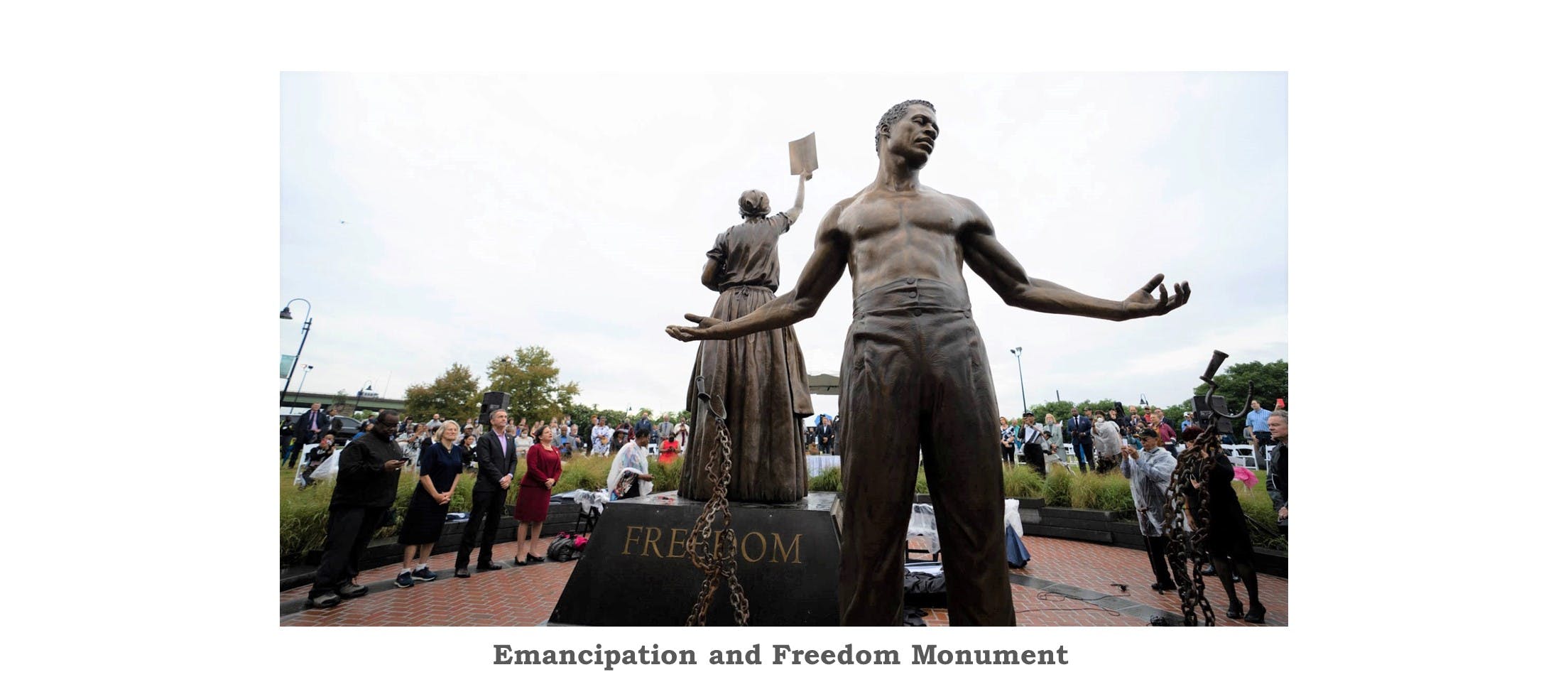
Emancipation and Freedom Monument
The Virginia Dr. Martin Luther King, Jr. Memorial Commission dedicated and unveiled a new monument highlighting Virginia’s – and America’s – African American history on September 22, 2021 on Brown’s Island. The newly constructed Emancipation and Freedom Monument, was commissioned and designed by artist and sculptor, Thomas Jay Warren, of Oregon. It features two 12-foot bronze figures – a male and female holding an infant – representing those newly freed from slavery. A pedestal, which elevates the female figure, features images and contributions of ten Virginians whose efforts represent the sacrifices of those eager to gain freedom both before and after Emancipation: Richmonder Mary Elizabeth Bowser, William Harvey Carney, Gabriel, Dred Scott, Nat Turner, Rosa Dixon Bowser, John Mercer Langston, John Mitchell, Jr., Lucy Simms and Rev. Wyatt Tee Walker.
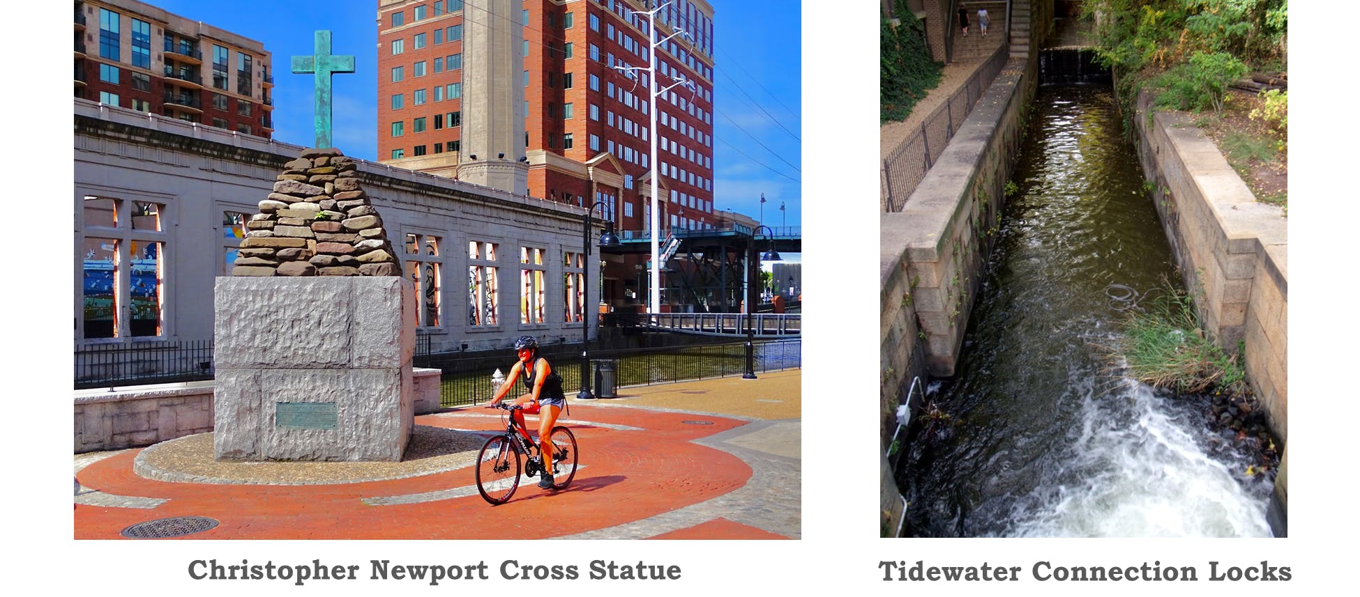
Richmond Statues and Public Art Along Canal Walk
Christopher Newport Cross Statue
On May 24, 1607, Capt. Christopher Newport and a party of explorers who had landed at Jamestown just days earlier arrived at the site of modern-day Richmond and planted a cross in honor of King James I of England. In the decades following Newport’s visit, steady inroads by Europeans into Native American territories led to numerous hostilities and several wars. In 1646, a treaty gave much of eastern Virginia to the English. By the early 18th century, the land along the falls was part of a large plantation owned by William Byrd, the region’s most prominent trader in furs, tobacco, rum and slaves. In 1705, the plantation passed to William Byrd II, who, when pressed by the Colonial assembly to set up a town at the site of his trading post, laid out 34 squares of four lots each, thus founding Richmond. In recognition of the significance of the area’s early history, the Association for the Preservation of Virginia Antiquities erected a cross in 1907. Today, this cross is located on the Canal Walk at 261 S. 12th Street.
Tidewater Connection Locks Exhibit
In 1854, the Tidewater Connection Locks linked the canal basin to the James River tidewater below Richmond. The system contained five granite locks, each measuring 15 by 100 feet. This resulted in a flight of water stairs that lowered boats a total of 69 feet within a distance of three and a half blocks. A sixth lock, the Great Ship Lock, was located 1.5 miles east near Pear Street. Traffic on the canal peaked in the late 1850s following completion of the Tidewater Connection Locks. However, the canal suffered heavily with the expansion of railroads. In 1880, the canal was sold to the predecessor of the Chesapeake and Ohio Railway System (now CSX) and the towpath was largely converted to rail beds. The Tidewater Connection Locks are located in the canal at the end of S. 12th Street. A large-scale locks model exhibit is located on the Canal Walk just east of the locks.
While walking along the Canal Walk from Brown’s Island to the Flood Wall at 17th Street, you will notice embedded into the pathway bronze medallions that mark specific points in Richmond and America's history. Learn more about these medallions along the Canal Walk here.
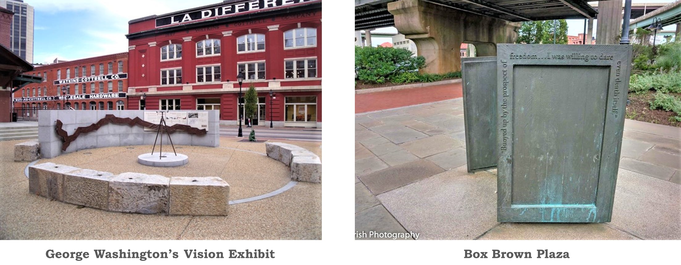
George Washington’s Vision Exhibit
George Washington promoted the concept of a great central waterway long before he became the nation’s first president. A surveyor of western lands as a young man and later a landowner of vast tracts beyond the Allegheny Mountains, Washington had close knowledge of the western territories, which he feared France and Spain would control if trade routes to eastern markets were not established. In the early 19th century, other far-sighted Virginians took over Washington’s leadership role. The final elements of his plan were completed in the 1820s, when the Kanawha Turnpike joined the headwaters of the James River to the Kanawha River. In 1835, the James River and Kanawha Co. was formed, and within 15 years, a canal system stretched 197 miles to Buchanan.
An exhibit illustrating George Washington’s vision and the construction of canals along the James River stands at the Turning Basin Plaza between Virginia and 14th Streets. A set of elegant bronze reliefs recognizes Washington’s early vision of the country’s westward expansion and the importance of uniting the new territories with the eastern states. Integrated with seating, the reliefs provide a bronze and granite surround for a bronze replica of a period surveyor’s transit mounted on granite in the center of the exhibit. This exhibit is located at 139 Virginia Street, next to the Turning Basin and Riverfront Canal Cruises.
Box Brown Plaza
Richmond’s riverfront is steeped in African-American history. African-Americans worked on the river and canals, in the iron works and tobacco warehouses. Among the most famous enslaved persons in Richmond’s history is Henry “Box” Brown, who worked in a tobacco warehouse at Cary and 14th Streets when his family was sold to a North Carolina plantation. Overcome with grief, Brown contacted an agent of the Underground Railroad, who helped him mail himself to freedom. A metal reproduction of the box in which Brown escaped can be viewed on the Canal Walk near S. 15th and Dock Streets.
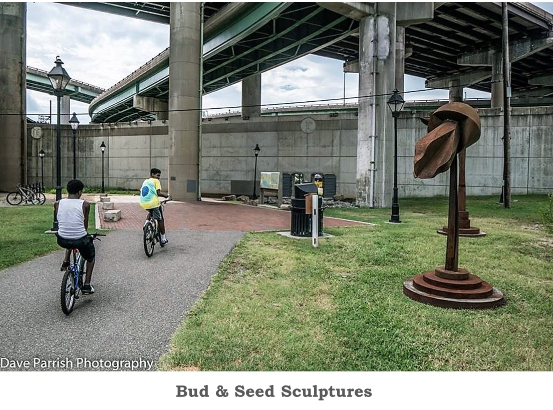
Bud & Seed Sculptures
Installed in May 2010 as a set of free-standing steel sculptures, they depict flowers unfurling. Located at the start of the Virginia Capital Trail near Dock and S. 18th Streets, the three 9½- to 11-foot-tall pieces by artist David Boyajian are called "The Bud and Seed Group." The artwork evokes themes of nature, industry and rebirth, the artist said. "I think it's the element of nature and the industrial quality of the area. It's sort of the dichotomy of the two -- the coming together. They're budding forms." - Richmond Times-Dispatch
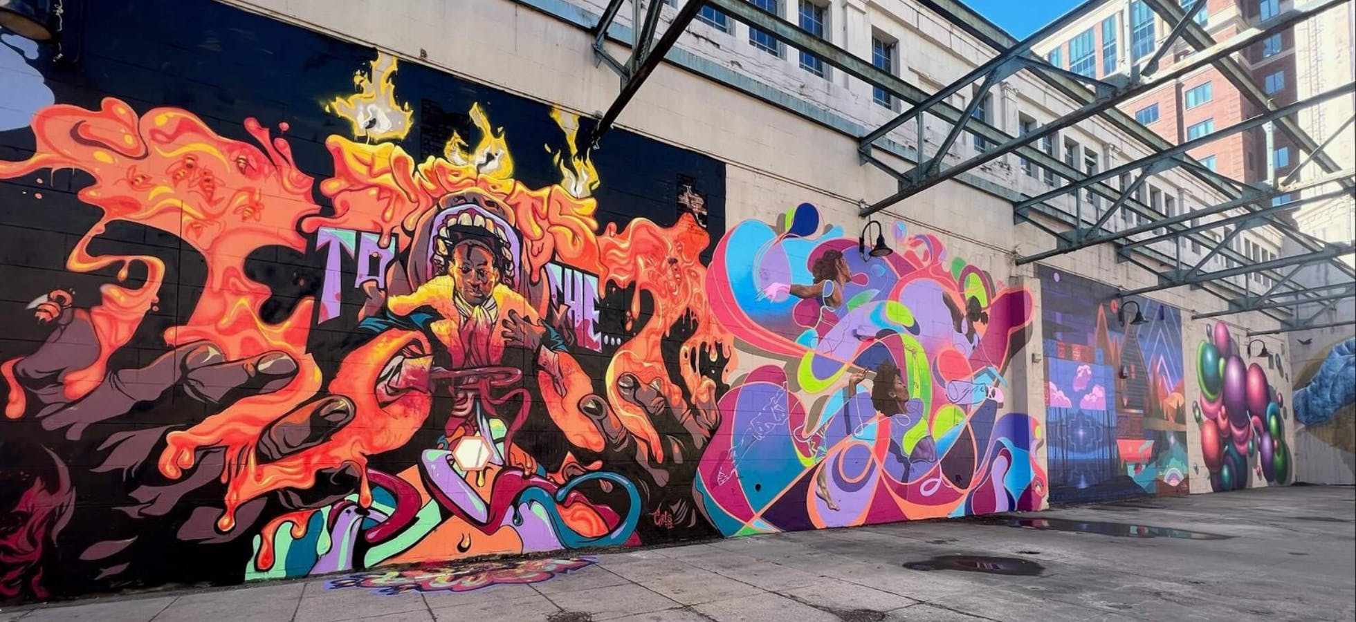
Canal Walk Murals
The inaugural RVA Street Art Fest took place April 14, 2012, and brought together more than a dozen national street artists, who created an outdoor gallery along Richmond’s James River Power Plant Building and Riverfront Canal Walk. The artists created gigantic works of art in the form of 18' x 32' murals, which were on display until September 2022 when the old murals were given a new life by local artists!
The goal was to show the creative power of street art, liven up public spaces throughout the city and attract people and tourists to the outdoor art gallery, as well as showcase the Canal Walk and Shockoe neighborhood.
Public Art and Statues Along Richmond's Riverfront
On downtown’s south side of the James River from west to east
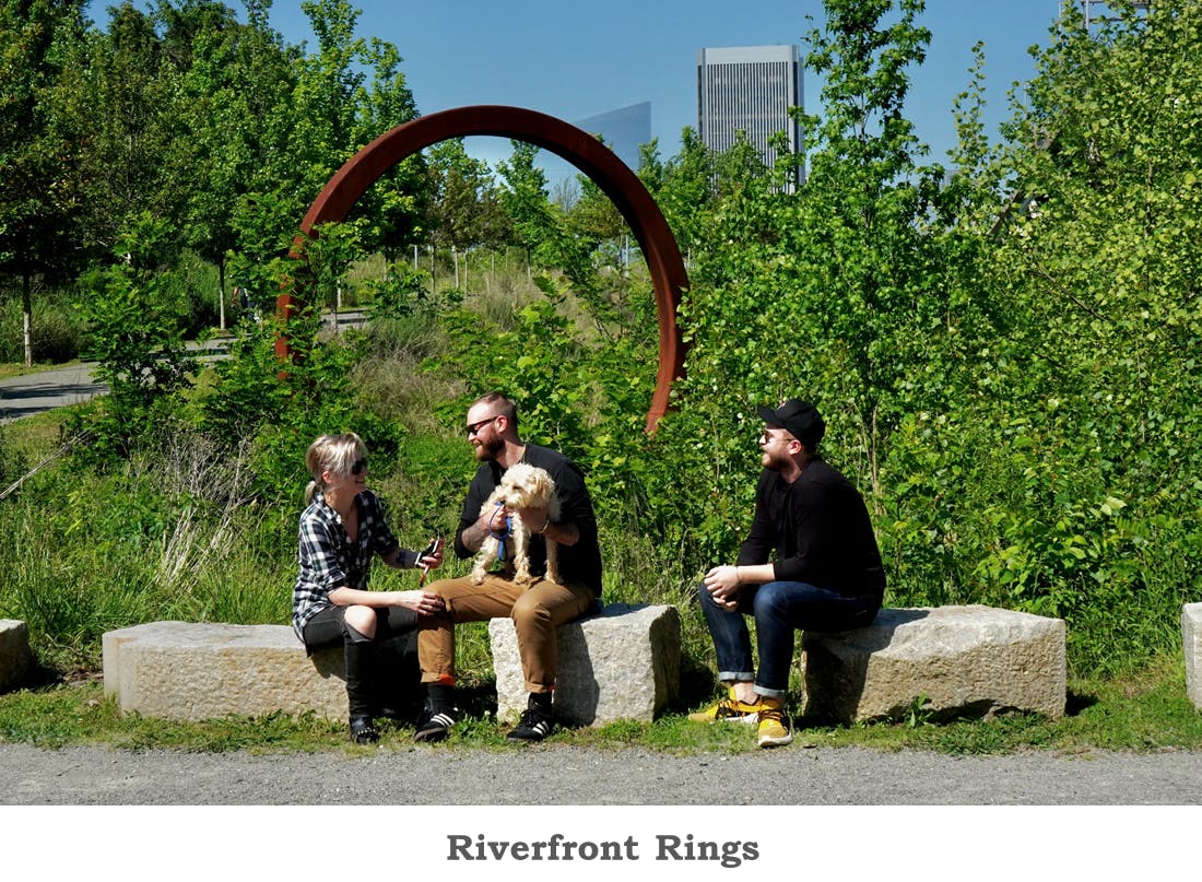
Riverfront Rings
Installed in October 2016, the eight 17-foot steel rings located near the south entrance of the T. Tyler Potterfield Memorial Bridge allows for great public outdoor interaction. “It’s a gentle nod to the biking community, and the [Americans with Disabilities Act] connection,” artist Joshua Wiener says. “My dad is in a wheelchair now. My brother has a disease where he will be soon. And we grew up going into nature. The accessibility that this bridge provides is like a wheel into nature. And [the rings] make their own path: It rolls up the hill, it rolls down. It creates this whole other trail.” The steel rings evoke the feeling that the bridge connects the Manchester neighborhood to downtown Richmond. “Manchester is heavily industrial.” The City of Richmond hired Wiener for the riverfront art installation, titled “The Path Untraveled.” - Richmond Magazine
If you’re looking for a place to park near Richmond’s riverfront or need to find the best way to get into the city, look no further than our Parking and Transportation in Downtown Richmond guide!
Parking and Transportation
Free Riverfront Parking:
- On-street parking on S. 2nd Street between Brown’s Island Way and E. Byrd Street (limited daytime parking)
- On-street parking on S. 5th Street on the west side of the street from Tredegar to E. Byrd Street (limited daytime parking)
- The Belle Isle parking lot is located at the corner of Tredegar Street and Brown’s Island Way (limited daytime parking)
Paid Public Riverfront Parking:
- American Civil War Museum parking lot located at 480 Tredegar Street (limited hours; closed after 4pm daily; closed during Allianz Amphitheater at Riverfront events)
- Delta Hotels by Marriott parking deck, 555 E. Canal Street (Open 24/7; 1 Hour $7.00; 2 Hours $14.00; Evening $7.00)
- 5th & Canal Street, Public parking after 5:00pm on weekdays, and 24/7 on weekends (Rates: $6.50 for 8 Hours; pay through “ParkMobile” by app or QR code, see signage on-site)
- 4th & Canal Street, Public parking 24/7 (Weeekday Rates: $4.50 for 1 Hour; $9.00 for 2 Hours; $13.50 for 3 Hours; Evening Rate: $6.50 for 8 Hours; pay through “ParkMobile” by app or QR code, see signage on-site)
- 1200 E Byrd Street (Reynolds lot), Public parking 24/7 (Rates: see signage and pay-to-park kiosk on-site)
- See MAP for additional options
Riverfront Bike Parking/Riding:
- Bike racks are located along Tredegar Street, and at the vehicular bridge on the western end of Brown’s Island nearest historic Tredegar.
- Bike Share stations are located at the Turning Basin and at 620 Tredegar Street. Explore all of the RVA Bike Share stations here.
- Bike racks are located along Low Line Green, the Turning Basin, next to Casa Del Barco, on Tredegar Street between 5th and 7th Streets and at the vehicular bridge on the western end of Brown’s Island (nearest historic Tredegar).
Riverfront Bus Transportation:
Getting to Richmond's riverfront is easy when you take the GRTC public bus system. Just take the route #87 bus across the Lee Bridge from the north side of the river to the stops at 2nd Street and Brown's Island Way near Tredegar or at 2nd and Spring Street. The route #87 bus runs every 60 minutes. On its way back across the river, the bus stops at 2nd and Spring Street and again at 2nd Street closer to the Virginia War Memorial. Just look for the GRTC signs, or track your bus via the free Transit App!
Find more information about Parking and Transportation in Downtown Richmond here.
There are plenty of things to do on Richmond's Riverfront! Check out the Canal Walk and our Riverfront Canal Cruise boat tours.
